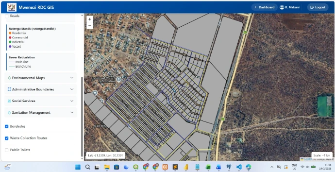
Mwenezi RDC Enterprise WebGIS Platform
The Challenge:
Mwenezi Rural District Council operated without any centralized geospatial system. Land records, infrastructure maps, and environmental data existed as paper documents and scattered digital files, making cross-departmental planning inefficient.
My Solution:
Designed and developed a comprehensive WebGIS platform from the ground up that centralizes all council spatial data into one interactive system accessible to multiple departments.
My Solution:
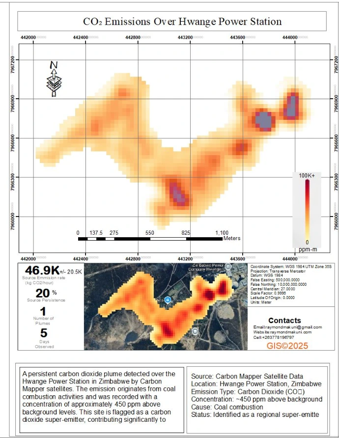
Produced a static map series analyzing satellite imagery to identify emission sources, vegetation stress, and land cover changes in the surrounding area
The Challenge:
Wanted to visualize and quantify carbon emissions and environmental impact around Hwange Power Station, one of Zimbabwe's major thermal power plants, to support environmental monitoring and reporting.
Hwange Power Station Carbon Mapping
My Solution:
Produced a static map series analyzing satellite imagery to identify emission sources, vegetation stress, and land cover changes in the surrounding area
The Challenge:
Wanted to visualize and quantify carbon emissions and environmental impact around Hwange Power Station, one of Zimbabwe's major thermal power plants, to support environmental monitoring and reporting.
Hwange Power Station Carbon Mapping
Groundwater Potential Mapping
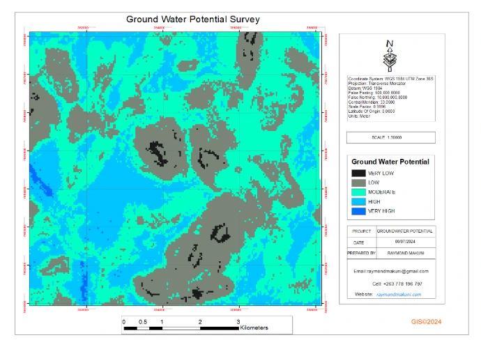
The Challenge:
Rural communities face water scarcity and needed identification of optimal sites for new boreholes to improve access to clean water.
My Solution:
Conducted a multi-criteria analysis integrating various datasets to produce a groundwater potential map showing zones with high, moderate, and low probability of successful borehole drilling..