Many researchers have explored the utilisation of modern day technology in agriculture. With the advanced technology at our disposal particularly Geographic Information Science and Remote sensing and its application in soil health mapping, its high time farmers take advantage this tool because the benefits are evident. Many might have the question, How? Why GIS and remote Remote Sensing?
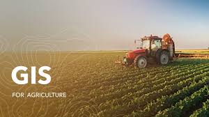
GIS in Agriculture
Well, I'm here to simplify this. With my extensive experience in application of GIS in agriculture, I'm very much perturbed with how as a nation we are under utilising this rich discipline which has many open source material yet valuable.
Looking at Tobacco as an example, which in Zimbabwe is an industry that is at the cornerstone of our national economy. Its long-term sustainability hinges on one critical factor that is soil health. As the sector faces mounting pressure to adopt environmentally responsible practices, cutting-edge technologies like GIS and remote sensing are emerging as game-changers.
Tobacco farming, especially when done intensively, can degrade soil quality over time leading to reduced yields, increased input costs, and environmental harm. Traditional soil testing methods, while valuable, are often limited in scale and frequency. That’s where GIS and remote sensing steps in.
Remote sensing uses satellite and aerial imagery to monitor land conditions in real time, we call it "seeing from the sky" to get insights on soil moisture, soil nutrient content and crops health through calculation of vegetation indices such as Nomalised Difference Vegetation Index, Nomalised Difference Water Index and Soil Adjusted Vegetation Index among others.These insights empower farmers to respond quickly to emerging issues before they become a problem.
GIS takes spatial data and turns it into actionable maps. For soil health, that is soil type mapping, identifying pH levels, organic matter, and nutrient profiles across farms.By layering soil data with climate, topography, and crop performance, GIS enables precision agriculture tailoring inputs to exactly where they’re needed.
Together, GIS and remote sensing offer a holistic view of Zimbabwe’s tobacco landscape. As Zimbabwe embraces digital agriculture, integrating GIS and remote sensing into soil health initiatives isn’t just smart it’s essential. These tools can help tobacco growers protect their most valuable asset that is THE LAND ITSELF